Viewing share maps
Share maps are the easy and secure way to share your maps with visitors, contractors and staff. Share map links will work for anyone - as long as the share map hasn’t expired or the share map is password protected (see Create Share Map Link).
Due to their digital nature, share maps can contain a lot more information than PDF or paper maps. They also have the added benefit of staying up to date automatically when changes are made in Landkind.
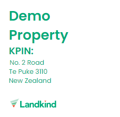
Property information:
The property information box contains the property's name and address. This will update automatically if the property’s name is updated in Landkind.
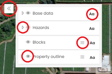
Layer and legend widget:
The layer and legend widget contains the legend, layer toggles, layer information and label toggles.
The double arrows in the top left will hide the box.
The ‘Aa’ will toggle labels on and off.
The three horizontal lines will display the legend.
The triangle next to the layer name will show the layers in that group.
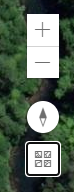
Controlling the map:
The top right corner contains controls for:
Zooming in an out
Rotating the map
Changing the basemap
You can also zoom in and out using a mouse (on a computer) or by pinching and expanding two fingers on the screen (on a mobile device).
You can also rotate the map by clicking and moving the right hand mouse button or two fingers.
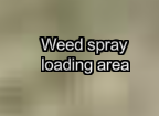
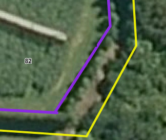
Custom text and graphics:
On the map you may notice purple lines and labels - these have been added by the share map creator and are specific to this share map.